The app that knows
your boat.
BlueHelm packs chart-smart trip routing, an anchor drift alarm, live float-plan tracking, marine weather and tides, and an AI that knows your boat — into one clean app.
BlueHelm packs chart-smart trip routing, an anchor drift alarm, live float-plan tracking, marine weather and tides, and an AI that knows your boat — into one clean app.
Real screenshots — swipe for more
Plan the trip, watch the weather, run the route, swing safe at anchor, and get home — with your boat's own knowledge a tap away.
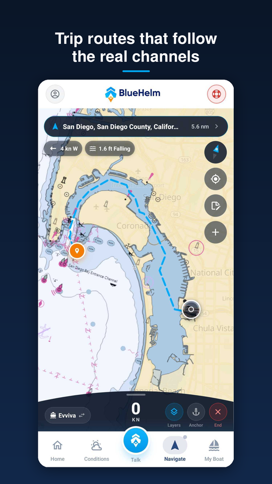
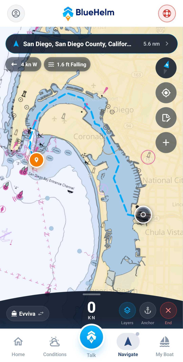
Trip routes computed over real NOAA chart data — down the channel, out the mouth, around the headland instead of a line drawn over land.
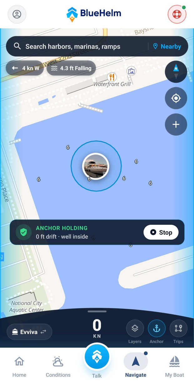
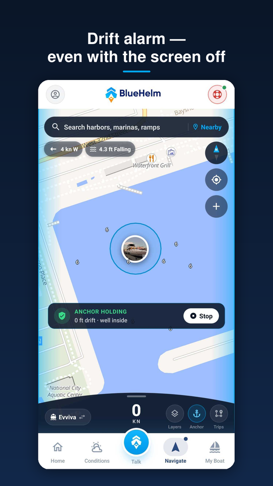
Drop the pin, set your swing radius, and sleep. If the boat drifts outside the ring, the alarm fires — even with the screen off.
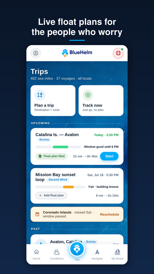
File a float plan to your contacts in one tap. They get your boat, route, and a live link showing your intended course and actual track.
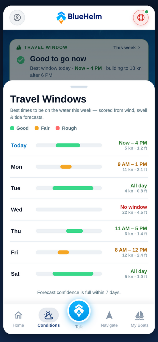
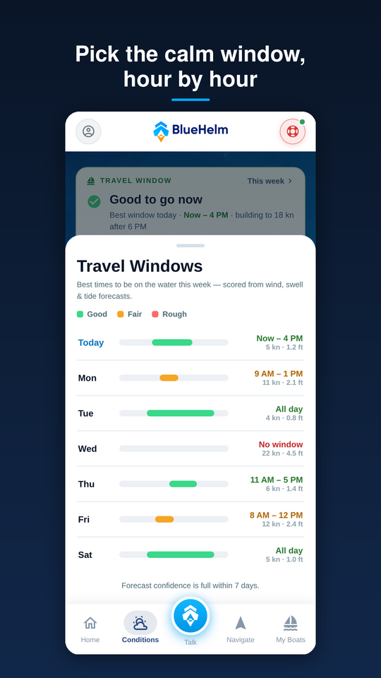
Wind, tide, waves, and water temperature for where you are — or anywhere you pick. Departure windows show the best time to leave.
One tap pins the spot with radio-ready coordinates and a line back. Hold to open a position text to your contacts — you review and send.
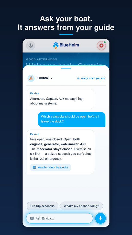
Answer a few questions and the AI writes your boat's operating guide — from exactly what you said. Emergency steps stay cached offline.
Pick a destination and BlueHelm plans the course a boater would actually run — using depth and channel data from NOAA charts, coast to coast across US waters.
Out the harbor, not over the sandbar. Routes thread the channels, clear the breakwater, and round the headlands.
Add stops mid-trip. Long-press the chart and the route bends through your new stop, in sailing order.
Buoys and markers on the chart, a live route line that follows your bow, and wind along your route by hour.
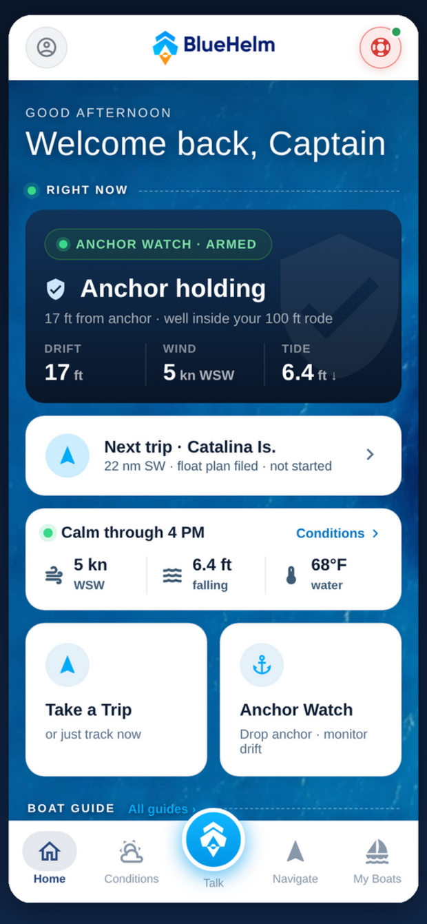
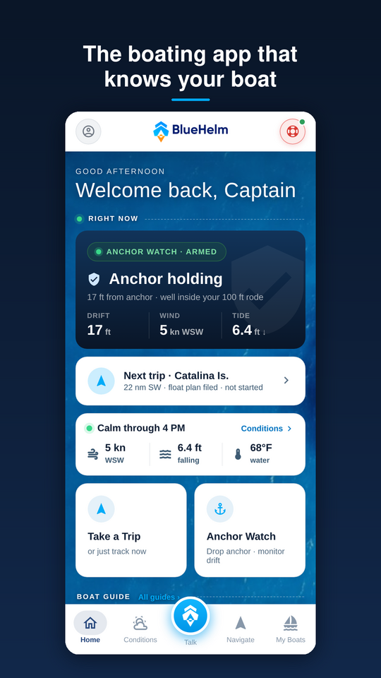
Drop anchor, set your rode, and the swing ring draws itself on the chart. Drift outside it and the alarm wakes you.
Works with the screen off — background GPS keeps watch while you sleep (allow location in the background).
Arm it mid-trip — pull into a cove, anchor for lunch, and keep the trip running.
Live drift, wind, and tide on the same screen, so you know why the boat is moving.
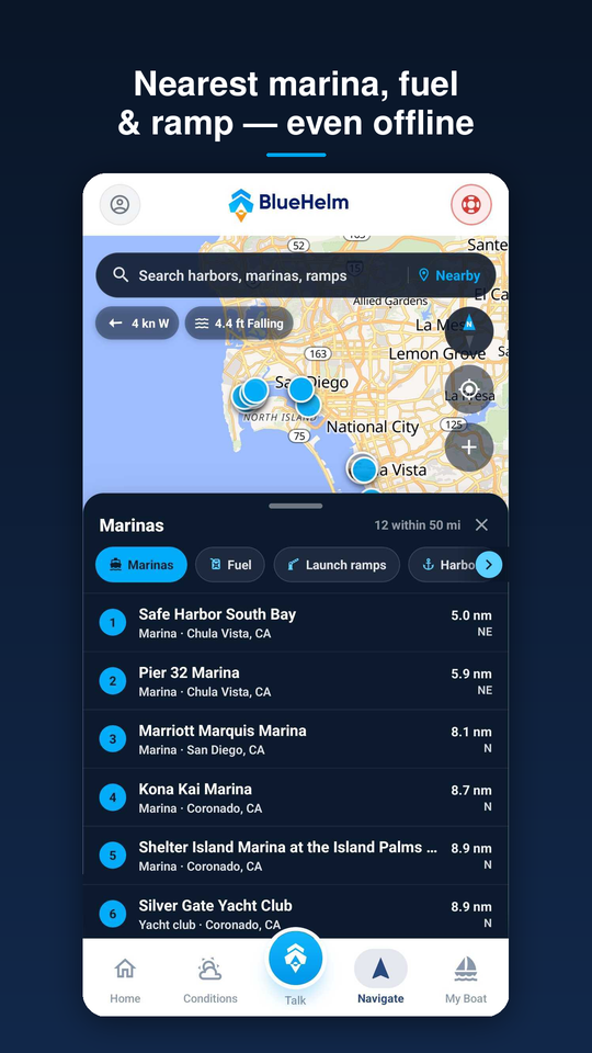
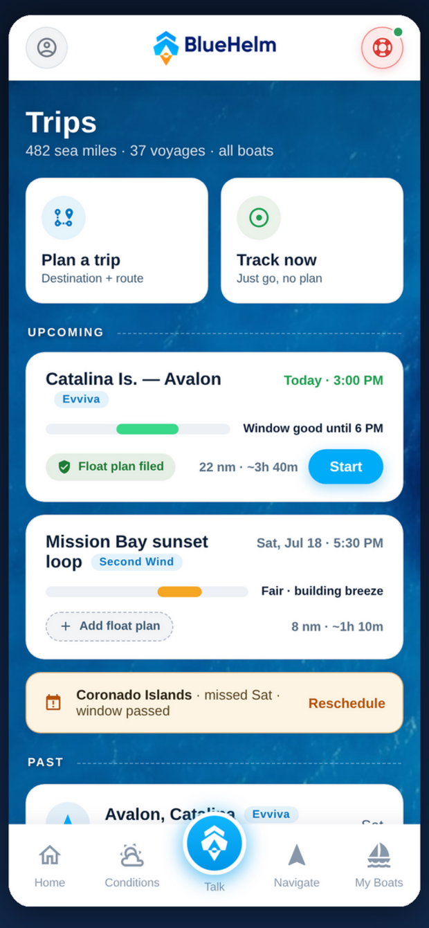
Search 16,000+ marinas, harbors, and anchorages — offline — and plan with real departure windows. Then let the people who care follow along.
File a float plan in one tap. Your boat, route, and timing go to your emergency contacts by email or text.
Live tracking link. A private link shows your intended route and actual path — no app needed on their end.
Every voyage saved. Distance, time, and the track on the chart, for every boat you run.
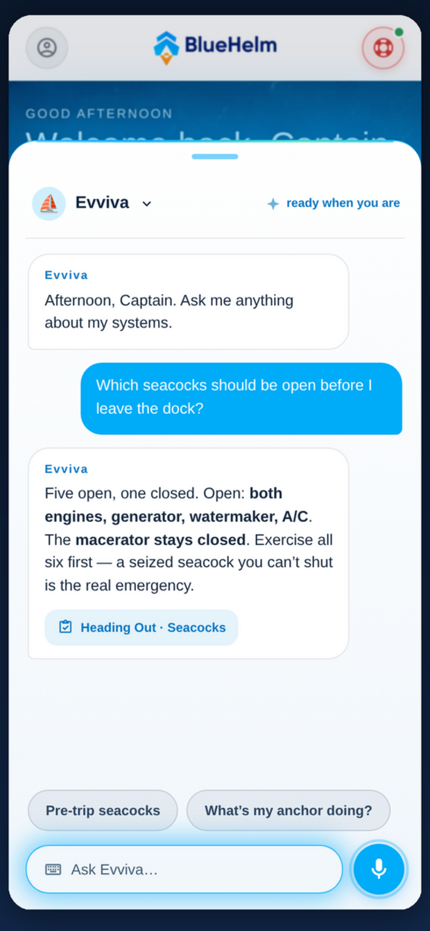
Answer a few questions about your boat and the AI writes its operating guide — only from what you said, never invented. Then talk to your boat by name.
“Which seacocks should be open before I leave the dock?” — answered from your boat's own systems.
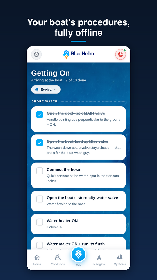
Step-by-step scenario flows — getting aboard, heading out, heading back, leaving the boat — with checkboxes.
Emergency procedures cached offline — taking-on-water steps are on your phone before you need them.
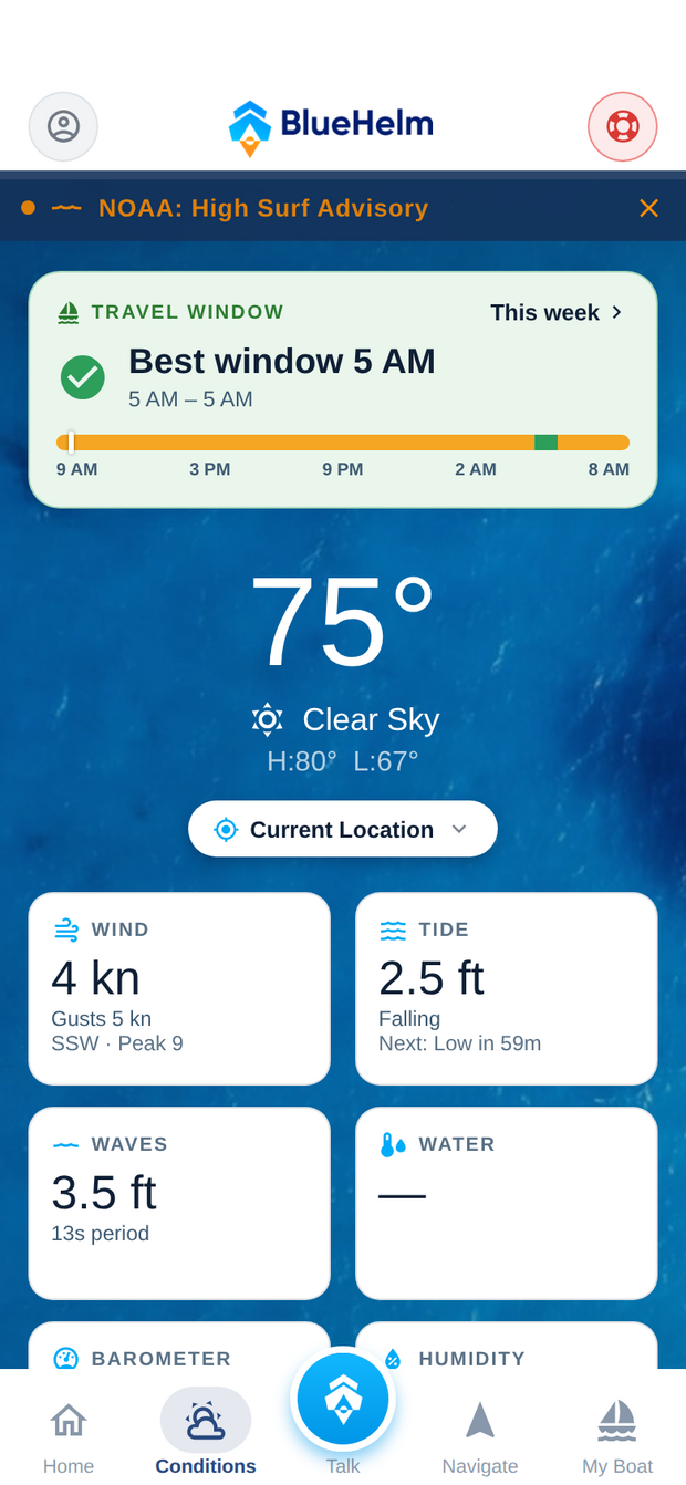
Wind, tides, waves, water temp — for your marina or anywhere you pick.
Departure windows show the calmest hours of the day at a glance.
Wind along your route, hour by hour, over the course you'll run.
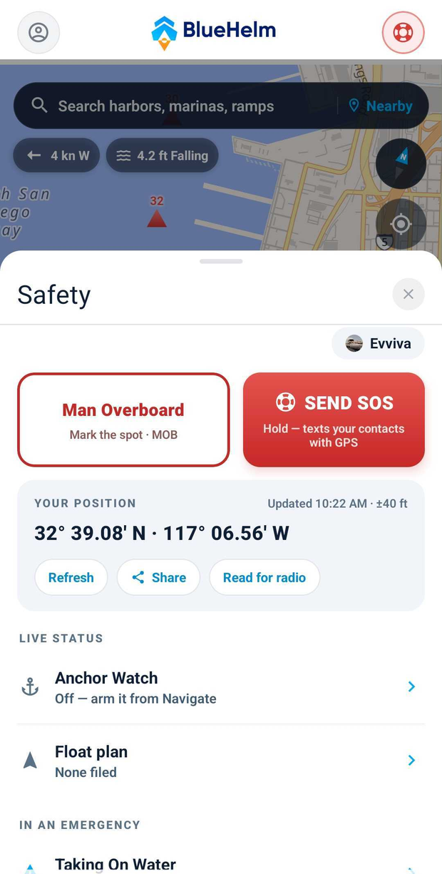
Man overboard — pin the spot instantly, with bearing, distance, and a line back.
Hold-to-SOS — opens a position text to your contacts. You review it, you send it.
Radio-ready position + a Mayday script you can read under stress.
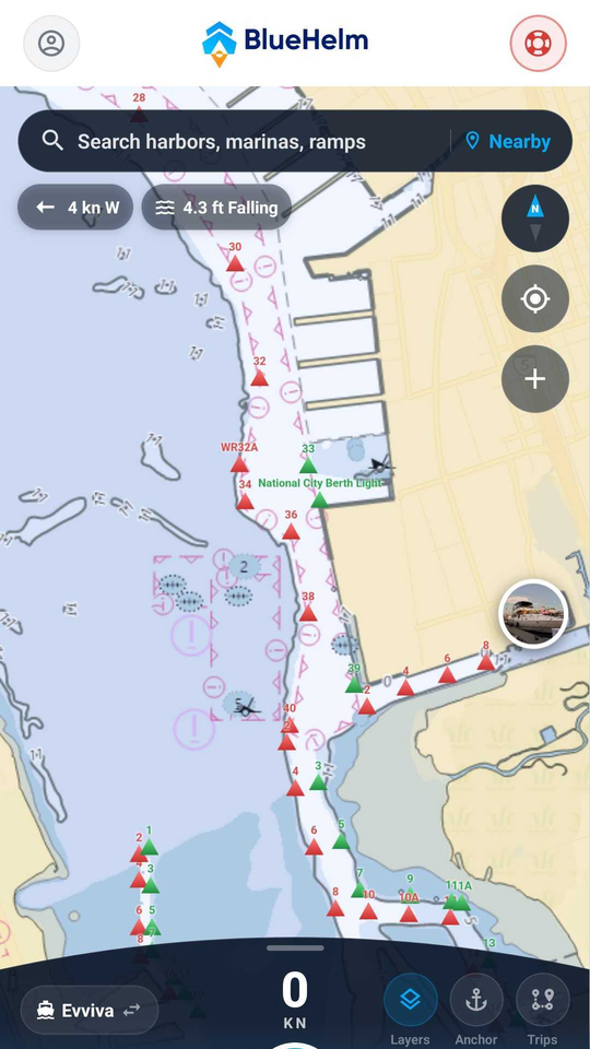
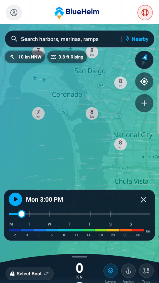
Real screenshots from the app — swipe for more
Start with the essentials free, and unlock the full helm — routing, float plans, and your boat's AI — with a subscription.
BlueHelm is a planning and awareness tool — not a substitute for seamanship, official charts, VHF radio, or emergency services. Routes are suggestions, cover US waters, and need a connection to compute; always verify against official charts and conditions. AI answers come from your boat's guide and can be wrong — verify anything safety-critical.